fuerteventura villas
Villas privadas de alquiler vacacional en Fuerteventura
Vive unas vacaciones increíbles en Fuerteventura y hospédate en nuestras villas frente al mar, equipadas con jacuzzi, sauna o piscina privada. Ven acompañado de tu familia, amigos o pareja y explora todas las comodidades que ofrecen nuestras villas privadas ubicadas al norte de Fuerteventura. Contamos con opciones en Corralejo, Villaverde, La Oliva y Lajares.
¡Encuentra la villa ideal para ti y reserva ahora para vivir una experiencia única en Fuerteventura!
-
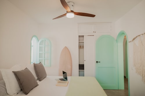
villa aloha
VILLA CON JACUZZI PRIVADO Y VISTAS AL MAR EN CORRALEJO
-
villa maluhia
VILLA CON VISTAS AL MAR Y JACUZZI PRIVADO EN CORRALEJO
-
ecovilla haleakala
VILLA PRIVADA CON PISCINA Y SAUNA
-
villa moana
VILLA CON JACUZZI PRIVADO Y VISTAS AL MAR EN LAJARES


Descubre fuerteventura
Descubre actividades y lugares de interés para visitar durante tu estancia en Fuerteventura. Te recomendamos los mejores lugares para describir la isla.